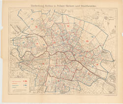
Eintheilung Berlins in Polizei - Reviere und Stadtbezirke.
Topographie, 1900
SM 2012-0855
Suche nach: 1900 - 2000 | Mehrfarbendruck | Übersichtsplan | mit Reproduktion
41 Objekte
Filter
Typ
Sammlung
Bild vorhanden 1
Materialien
Techniken 1
Schlagwort 1
Übersichtsplan (41)
Liniennetz (10)
U-Bahn (7)
Charlottenburg (6)
Straube (6)
S-Bahn (5)
Verkehrsplan (5)
BVG (3)
Kartenwerk (3)
Tourismus (3)
Datierung 1
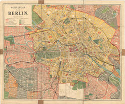
SCHULPLAN VON BERLIN.
Topographie, 1902
GDR 72/54 a, b
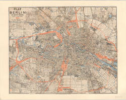
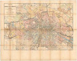
PLAN von BERLIN MIT NÄCHSTER UMGEBUNG.
Straube, Julius (1832-1913)
| Hersteller
Topographie, 1904
IV 03/12 R
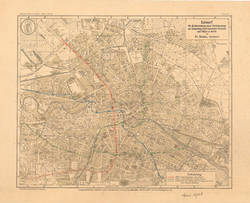
Entwurf für die Herstellung neuer Verkehrswege zur Entlastung stark belasteter Strassen und Plätze in Berlin
Topographie, 1904
IV 60/779 R
KARTE zur Berechnung des Grund- und Bodenwerthes...
Straube, Julius (Stich, Druck und Verlag)
| Autor
Topographie, 1904
IV 95/31 R a
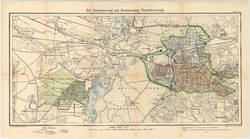
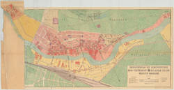
Die Entwässerung und Bewässerung Charlottenburgs.
Topographie, 1905
SM 2013-7341
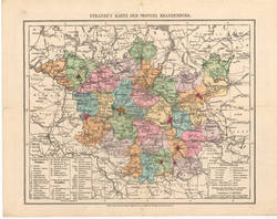
Straube`s Karte der Provinz Brandenburg
Straube, Julius (Stich, Druck und Verlag)
| Hersteller
Topographie, 1905
SM 2017-91943
JUL. STRAUBE´S ÜBERSICHTS-PLAN von BERLIN
Topographie, 1906
SM 2013-7382
UEBERSICHTSPLAN VON DT. WILMERSDORF Maßstab 1:2000 Blatt 1.-13.
Topographie, 1907
IV 60/704 R a-i, k-n
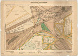
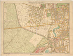
UEBERSICHTSPLAN VON CHARLOTTENBURG. Blatt 4.
Topographie, 1907
IV 60/776 R
ÜBERSICHTSPLAN DES GEMEINDEBEZIRKS OBER-SCHÖNEWEIDE BEI BERLIN UND DER NÄCHSTEN UMGEBUNG.
Topographie, 1907
SM 2013-7691
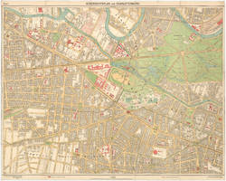
UEBERSICHTSPLAN VON CHARLOTTENBURG. Blatt 3.
Topographie, 1908
IV 60/649 R
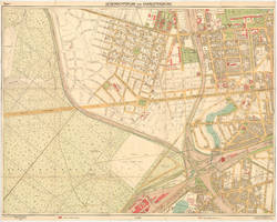
UEBERSICHTSPLAN VON CHARLOTTENBURG. Blatt 3
Topographie, 1908
IV 60/689 R
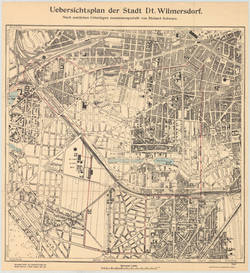
Uebersichtsplan der Stadt Dt. Wilmersdorf. Nach amtlichen Unterlagen zusammengestellt von Richard Schwarz.
Topographie, 1909
SM 2013-7402
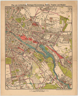
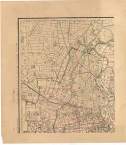
Plan von Lichtenberg, Boxhagen-Rummelsburg, Stralau, Treptow und Rixdorf.
Topographie, 1911
IV 60/658 R
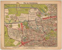
Plan von Charlottenburg
Topographie, 1911
IV 60/768 R a, b, c