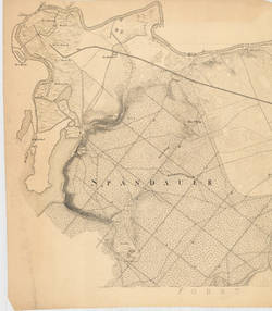
ohne Titel
Topographie, 1830
IV 60/31 R
Suche nach: | Objekt | nach 1800 | Charlottenburg | mit Reproduktion
16 Objekte
Filter
Typ 1
Sammlung 1
Bild vorhanden 1
Materialien
Techniken
Schlagwort 1
Charlottenburg (16)
Übersichtsplan (8)
Straube (5)
Situationsplan (4)
Westend (3)
Grunewald (2)
Bebauung (1)
Bebauungsplan (1)
Berlin (1)
Bewässerung (1)
Datierung 1
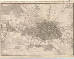
PLAN von BERLIN mit dem WEICHBILDE und der UMGEGEND bis CHARLOTTENBURG
Topographie, 1852
IV 59/409 R
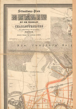
Situations-Plan von BERLIN MIT DEM WEICHBILDE und CHARLOTTENBURG
Topographie, 1874
IV 60/417 R
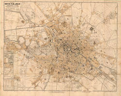
Kiessling`s Grosser Plan von Berlin, Charlottenburg u. Westend nebst den nächstgelegenen Ortschaften wie: Schöneberg, Wilmersdorf, Treptow, Stralau, Weissensee u.s.w. entworfen u. gezeichnet v. Th. Delius in Berlin.
Topographie, 1878
IV 02/12 R
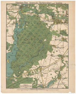
Situations=Plan: Grunewald, Charlottenburg und Spandau.
Topographie, 1893 - 1898
IV 59/392 R
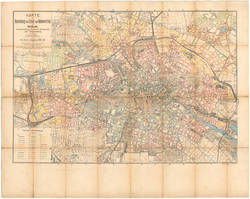
KARTE zur Berechnung des Grund- und Bodenwerthes...
Straube, Julius (Stich, Druck und Verlag)
| Autor
Topographie, 1904
IV 95/31 R a
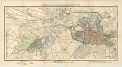
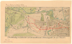
Die Entwässerung und Bewässerung Charlottenburgs.
Topographie, 1905
SM 2013-7341
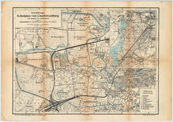
Kiesslings Schulplan von Charlottenburg mit Angabe der Stadtviertel...nebst einen Kärtchen vom Grunewald
Topographie, 1906
IV 60/164 R
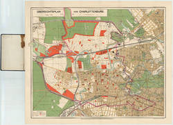
ÜBERSICHTSPLAN VON CHARLOTTENBURG.
Topographie, 1907
IV 60/662 R
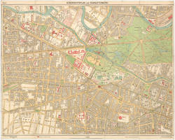
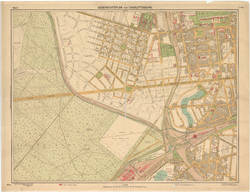
UEBERSICHTSPLAN VON CHARLOTTENBURG. Blatt 4.
Topographie, 1907
IV 60/776 R
Charlottenburg im Jahre 1908 und der anschließende Bebauungsplan bis zur Havel.
Topographie, 1908
IV 59/436 R
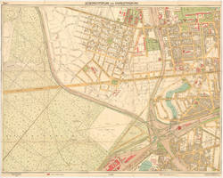
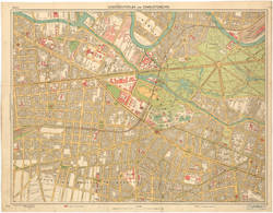
UEBERSICHTSPLAN VON CHARLOTTENBURG. Blatt 3.
Topographie, 1908
IV 60/649 R
UEBERSICHTSPLAN VON CHARLOTTENBURG. Blatt 3
Topographie, 1908
IV 60/689 R
UEBERSICHTSPLAN VON CHARLOTTENBURG. Blatt 4.
Topographie, 1910
IV 60/666 R
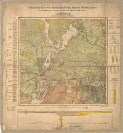
Geologische Karte von Preußen und benachbarten Bundesstaaten... Charlottenburg
Topographie, 1910
IV 60/687 R
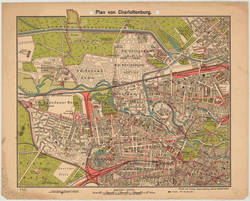
Plan von Charlottenburg
Topographie, 1911
IV 60/768 R a, b, c